Mapping Water Pollution in Pittsburgh
Systems mapping and data visualization for transition design
Transition Design Seminar, Spring 2024
Team: Kimberly Blacutt, Bea Maggipinto, Jocelyn Morningstar, Deeya Parikh, Max Shim
Pittsburgh has a water pollution problem. Combined sewer overflows dump billions of gallons of untreated sewage into local rivers every year. I spent a semester mapping this wicked problem - visualizing the systems, stakeholders, historical evolution, and potential interventions.
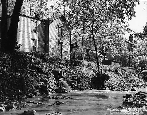
The Problem
Pittsburgh's sewer system combines stormwater and sewage in the same pipes. When it rains heavily, the system overflows, dumping raw sewage directly into the Allegheny, Monongahela, and Ohio rivers. In mapping a wicked problem we explain how multiple entangled causes have caused the current water pollution issues in Pittsburgh.
The Stakeholders
Who's involved and affected by Pittsburgh's water pollution? Everyone from ALCOSAN (the sewer authority) to local environmental groups, from municipal governments to affected communities. Our team mapped the relationships, power dynamics, and conflicting interests between overlapping stakeholder groups, including non-human entities such as endangered mollusks.
The History
How did we get here? We traced the evolution of Pittsburgh's water pollution problem from industrialization through the Clean Water Act to present-day infrastructure crises. Understanding the system's history reveals why it's so hard to change.
The Vision
What would clean rivers look like? Our team worked backward from a desirable future to identify the transitions needed to get there, from policy changes to infrastructure investments to community engagement.
The Interventions
We proposed an ecology of interventions. Not a single solution, but a network of coordinated actions across multiple scales and timeframes. From green infrastructure pilots to policy advocacy to public education campaigns.